startinpy#
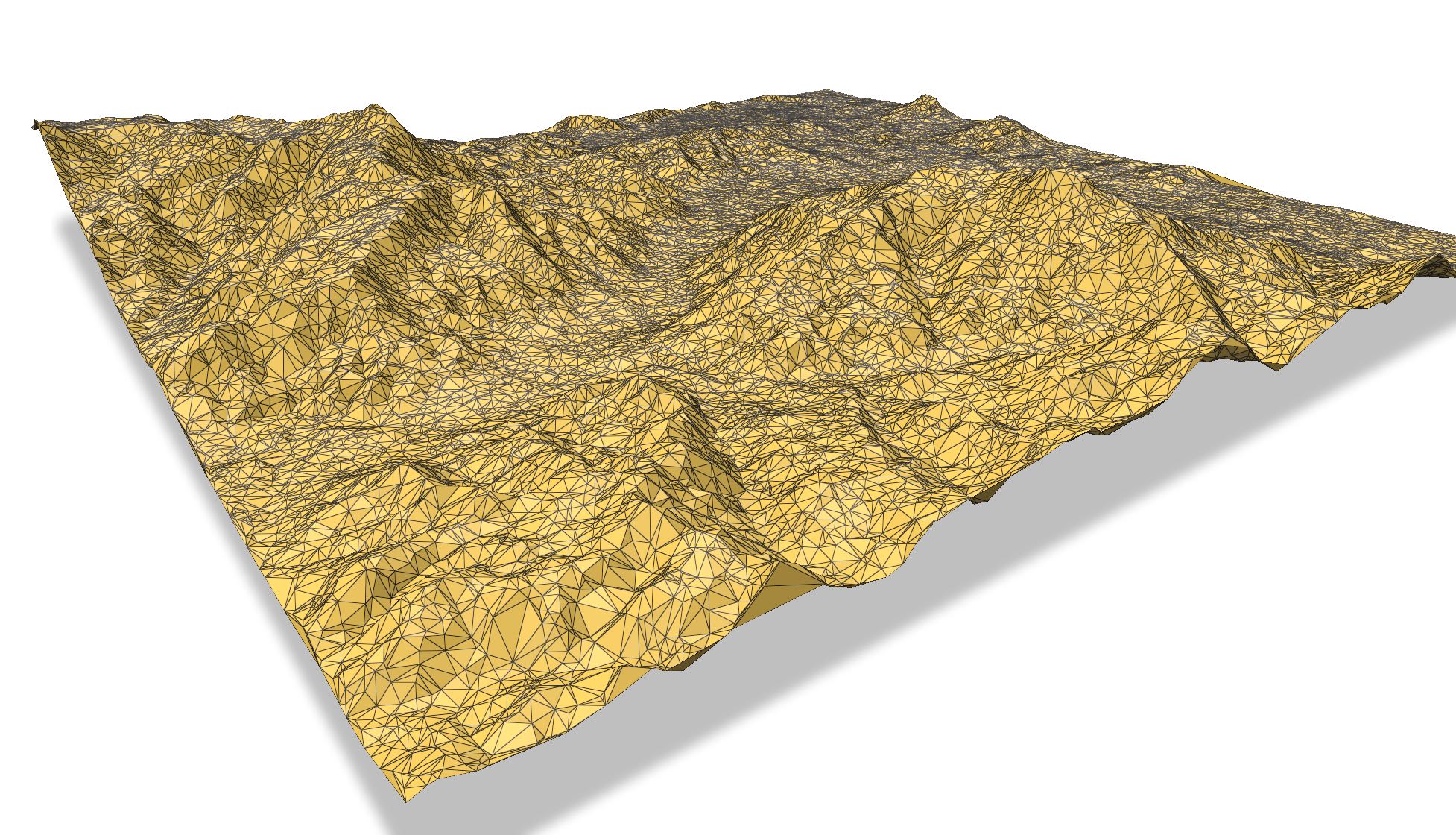
A Delaunay triangulator where the input are 2.5D points (they have an elevation), the Delaunay triangulation (DT) is computed in 2D but the elevation of the vertices are kept. This is used mostly for the modelling of terrains, but other attributes could be used.
Originally written in Rust (so it’s rather fast; see Rust code), and robust arithmetic is used (so it shouldn’t crash). The Python bindings just wrap the Rust code.
startinpy allows you to:
insert incrementally points
delete vertices (useful for simplification, interpolation, and other operations)
interpolate with a few methods: TIN, natural neighbours, Laplace, IDW, etc.
read directly LAS/LAZ files
outputs the TIN to several formats: OBJ, PLY, GeoJSON, and CityJSON
import startinpy
import numpy as np

#-- generate 100 points randomly in the plane
rng = np.random.default_rng()
pts = rng.random((100, 3))
pts = pts * 100

dt = startinpy.DT()
dt.insert(pts)

#-- remove vertex #4
try:
    dt.remove(4)
except Exception as e:
    print(e)

print("# vertices:", dt.number_of_vertices())
print("# triangles:", dt.number_of_triangles())

print("CH: ", dt.convex_hull())

print(dt.is_triangle([4, 12, 6]) )
print(dt.is_triangle([5, 12, 6]) )

print("--- /Points ---")
for each in dt.points:
    print(each)
print("--- Points/ ---")

alltr = dt.triangles
print(alltr[3])

zhat = dt.interpolate({"method": "TIN"}, [[55.2, 33.1]])
print("result: ", zhat[0])
Table of content#
- Installation
- How startinpy works
- Examples
- API
DTDT.adjacent_triangles_to_triangle()DT.adjacent_vertices_to_vertex()DT.closest_point()DT.collect_garbage()DT.convex_hull()DT.get_bbox()DT.get_point()DT.has_garbage()DT.incident_triangles_to_vertex()DT.insert()DT.insert_one_pt()DT.interpolate()DT.is_finite()DT.is_inside_convex_hull()DT.is_triangle()DT.is_vertex_convex_hull()DT.is_vertex_removed()DT.locate()DT.number_of_triangles()DT.number_of_vertices()DT.pointsDT.read_las()DT.remove()DT.snap_toleranceDT.trianglesDT.vertical_exaggeration()DT.write_cityjson()DT.write_geojson()DT.write_obj()DT.write_ply()
- Issues? Bugs? Questions?